Territories: The Claiming of Space by David Storey
Author:David Storey [Storey, David]
Language: eng
Format: azw3
Publisher: Taylor and Francis
Published: 2012-03-15T04:00:00+00:00
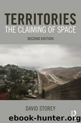
Figure 5.7 Ireland
agreement in 1998 led to the creation of a power-sharing assembly involving both Ulster unionists and Irish nationalists. While this endures (despite some tensions), paramilitary activity by fringe groups periodically resurfaces, although the overall situation remains relatively stable and peaceful. Nevertheless, the underlying issue of the future of the region as Irish or British remains. Although the current resolution has been accepted by the major factions on both sides, it is based on a recognition of the ethno-national categories involved and, hence, an acceptance of their territorial bases. In a way analogous to the Bosnian situation, it might be argued that this represents an acceptance (and to some extent an entrenchment) of divisions rather more than a transcending of them (Anderson 2008).
Territory continues to play a significant role in the conflict. Even the very act of naming the territorial entity is fraught with difficulty and ambiguity. Republicans tend to prefer the terms ‘north of Ireland’ or ‘Six Counties’ to ‘Northern Ireland’, thereby expressing their non-recognition of its legitimacy. Unionists prefer the term Ulster, partly, it might be surmised, because it avoids the word ‘Ireland’ and tends to confer a sense of being a place separate from the rest of the island. While references to specific places and the utilization of territorial strategies have been central to unionist tactics, it has been argued that a key problem for unionists is their inability to marshal an adequate set of place images of ‘Ulster’ (Graham 1994). Geographic imagery of Ireland as a particular type of place has been the preserve of republicans. Unionists, in seeing themselves as British, have dissociated themselves from images of Ireland and Irishness, but they equally do not fit neatly into notions of Britishness and cannot readily identify with place images of ‘Britain’.
The political and sectarian fault lines in the north are reflected in a distinct territorialization. In urban areas in Northern Ireland, there are Catholic residential districts and Protestant districts. Essentially, cities such as Belfast have what are, effectively, Protestant ghettos and Catholic ghettos. However, it should be borne in mind that this ethnic reading of the conflict can be slightly misleading: not all Catholics are nationalist and similarly not all Protestants are unionist. Nevertheless, it is apparent that there is considerable religious segregation even if this cannot, and should not, be seen to correspond completely to people’s wider political beliefs. Once again, this spatial segregation reflects power imbalances and highlights the ways in which political relationships are mapped onto space. In Belfast, where the so-called Shankill–Falls divide separates the two groups in the west of the city, a very high degree of segregation occurs, highlighted by the inappropriately named ‘peace lines’ – walls literally dividing roads in the area and designed to prevent confrontations between the two sides. Parts of the city are seen as out-of-bounds to one side because it is the other’s territory and many lead lives which are spatially restricted to shops and leisure spaces within their own territory (Shirlow and Murtagh 2006).
Download
This site does not store any files on its server. We only index and link to content provided by other sites. Please contact the content providers to delete copyright contents if any and email us, we'll remove relevant links or contents immediately.
| Anthropology | Archaeology |
| Philosophy | Politics & Government |
| Social Sciences | Sociology |
| Women's Studies |
Cecilia; Or, Memoirs of an Heiress — Volume 1 by Fanny Burney(32639)
The Great Music City by Andrea Baker(32611)
Cecilia; Or, Memoirs of an Heiress — Volume 2 by Fanny Burney(32013)
Cecilia; Or, Memoirs of an Heiress — Volume 3 by Fanny Burney(31997)
We're Going to Need More Wine by Gabrielle Union(19111)
All the Missing Girls by Megan Miranda(16337)
Pimp by Iceberg Slim(14687)
For the Love of Europe by Rick Steves(14599)
Bombshells: Glamour Girls of a Lifetime by Sullivan Steve(14142)
Norse Mythology by Gaiman Neil(13460)
Talking to Strangers by Malcolm Gladwell(13448)
Fifty Shades Freed by E L James(13293)
Mindhunter: Inside the FBI's Elite Serial Crime Unit by John E. Douglas & Mark Olshaker(9423)
Crazy Rich Asians by Kevin Kwan(9349)
The Lost Art of Listening by Michael P. Nichols(7554)
Enlightenment Now: The Case for Reason, Science, Humanism, and Progress by Steven Pinker(7356)
The Four Agreements by Don Miguel Ruiz(6841)
Bad Blood by John Carreyrou(6675)
Weapons of Math Destruction by Cathy O'Neil(6372)
